
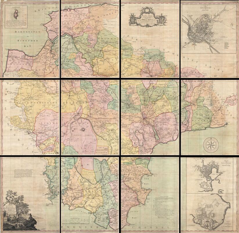
Historical Map of Devonshire
Back in Time to 1765
This is a rare and important Wall Map of Devonshire by Benjamin Donn in 1765. Drawn in twelve panels, this map covers the entirety of Devonshire or Devon from the English Channel to Barnstaple (Bideford) Bay and from Cornwall to Somerset at a scale of 1 inch to 1 mile. Donn also incorporates large insets of Exeter (showing the college), Plymouth, Plymouth Dock, Stoke Town, and the Isle of Lundy.
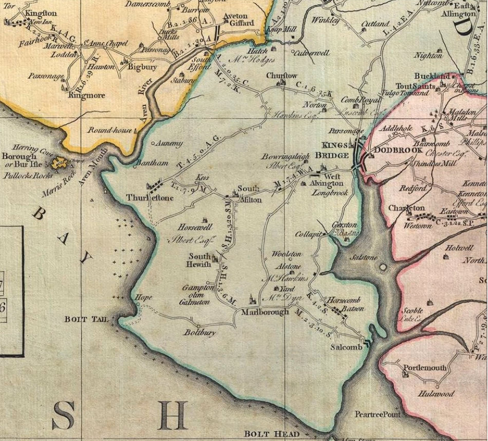
Interesting to view our parish at that time!
Interesting to view our parish at that time!
Below the main comprehensive twelve panel map in the pane of our area directly and can be viewed in detail on the webpage
This map is large and with wonderful detail which really cannot be seen on the image below.
It is best to download the larger file attached to view at your leisure!
It is best to download the larger file attached to view at your leisure!